
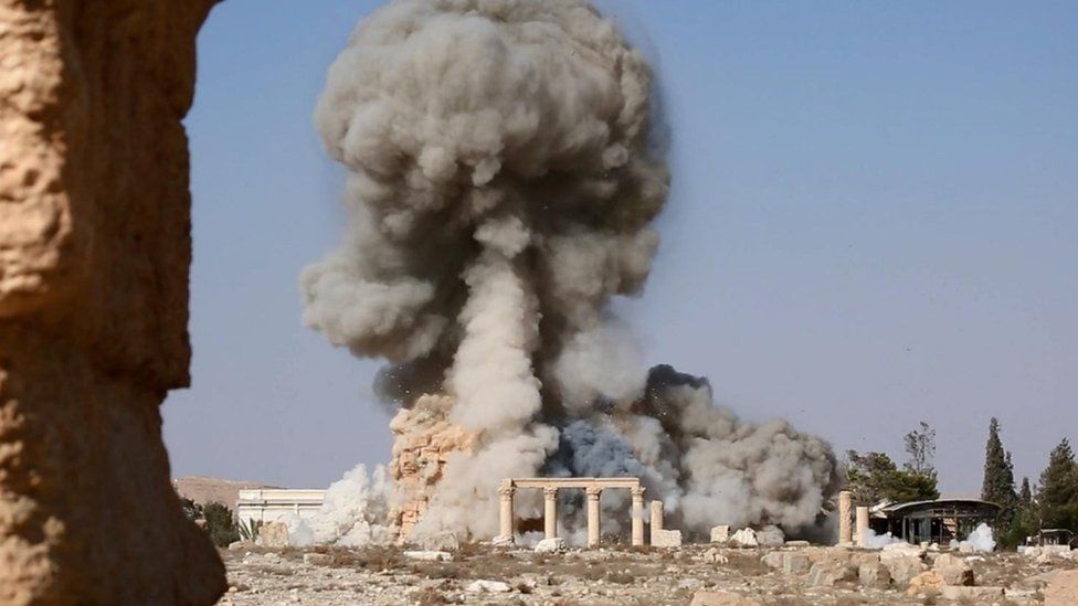
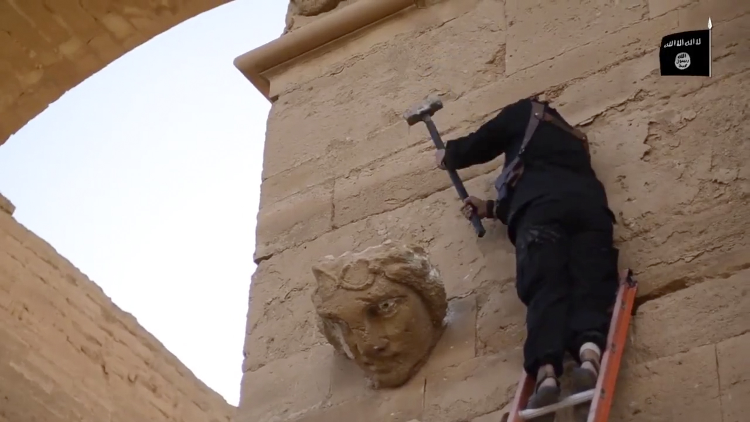
(AP Photo/Militant video)
Ancient History, Modern Destruction: Assessing the Status of Syria’s Tentative World Heritage Sites Using High-Resolution Satellite Imagery
Executive Summary
Introduction
Data and Methods
World Heritage Site Analysis
1. The Ancient Site of Dura-Europos
2. The Ancient Site of Ebla
3. Hama’s Historic Waterwheels
4. The Ancient Site of Mari
5. The Old City of Raqqa
6. The Archaeological Site of Ugarit
Conclusion
Acknowledgements
References Cited
Following an earlier report on the World Heritage Sites of Syria,1 the Geospatial Technologies and Human Rights Project of the American Association for the Advancement of Science (AAAS) undertook an assessment of Syria’s Tentative World Heritage sites using high-resolution satellite imagery. Syria has nominated twelve sites to the UNESCO Tentative World Heritage List2 and AAAS will produce two reports, each consisting of six sites, on the current state of those sites. This report details the condition of: Dura Europos, Ebla, Hama’s Waterwheels, Mari, Raqqa, and Ugarit (Figure 1). The purpose of the assessment was to determine the current status of each site. Analysis indicates that four of the six Tentative World Heritage sites assessed in this report exhibit significant damage.
Figure 1: Overview of six of Syria’s twelve Tentative World Heritage sites

Map: AAAS
Damage to Syria’s cultural heritage has been widely reported in the news and in social media since the outset of the present civil war in 2011. The potential for harm likely extends to all Syrian sites that have been submitted to the World Heritage list. Syria has nominated twelve sites to the UNESCO Tentative List for consideration for future inscription on the World Heritage List. Eleven sites were nominated in 1999, two of which were re-nominated as part of the Euphrates Valley Landscape in 2011. This report will cover: Dura Europos, Ebla, Hama’s Waterwheels, Mari, Raqqa, and Ugarit.3 A subsequent report will present analysis of: Apamea, the Island of Arwad, Maaloula, Qasr al-Hayr ach-Charqi, Sites of the Euphrates Valley, and Tartus.
A number of reports summarizing damage to Syria’s cultural heritage have appeared since the onset of the conflict. To date, overviews have been published on World Heritage sites, Tentative World Heritage sites and the destruction of museums, historic structures, and archaeological sites. These include periodic reports by UNESCO,4 governmental5 and non-governmental organizations,6 activist groups,7 and scholarly articles.8 However, no work to date has documented the extent of damage to all of Syria’s Tentative World Heritage sites using recent high-resolution satellite imagery coupled with news media, social media, and verified, on-the-ground information. This report provides an assessment of six of the twelve Tentative Syrian World Heritage sites by comparing each site prior to the conflict to their current status, as visible in satellite imagery. Since this report is only an overview assessment, the two-part Tentative Syrian World Heritage site reports will be followed by in-depth analysis and time-series reviews of the data available for each individual site in order to construct a timeline of damage for each.
AAAS acquired the most recent high-resolution satellite imagery covering each of the six Tentative World Heritage sites that are the focus of this report. Imagery was available for all sites, with varying pre-conflict dates. In each case, an image from prior to the conflict was compared with the most recently acquired image. Satellites owned and operated by DigitalGlobe collected the imagery used, and access to the imagery was provided to AAAS by the United States Department of State through its NextView License. The relevant acquisition information is listed in tables in the following subsections.
1. The Ancient Site of Dura-Europos
Overview
Often called the “Pompeii of the desert,” Dura-Europos is an archaeological site located on the west bank of the Euphrates River in the Deir ez-Zor province of Syria. Founded by the Seleucids in the 3rd century BC, Dura-Europos covers approximately 140 acres and contains spectacular remains that date to the Hellenistic, Parthian, and Roman periods. Dura-Europos was likely originally intended to serve as a fortress guarding the river route to southern Iraq and became a strong outpost on the border between the ancient empires of the east and west. As both a frontier city and the main hub for caravan routes, Dura-Europos represents a rare blend of cultural traditions, including Greek, Mesopotamian, Aramaic, Persian and Roman influences. The rich cultural mix of life in the city is reflected in its sacred architecture, some of which is uniquely well preserved.9 There is a wide variety of religious structures at the site, including the Greek Zeus Kyrios temple, the shrine of Sumerian goddess Nanaia, the shrine of Syrian goddess Atargatis, and the temple of the Palmyran god Bel. Dura-Europos also contains the world’s best-preserved ancient synagogue, with wall paintings of figurative art, and is the site of one of the earliest Christian house chapels with the oldest depiction of Jesus Christ (235 AD).10 The site of Dura-Europos was nominated to the World Heritage Tentative List in 1999 and again as part of the Euphrates Valley Landscape in 2011.11
Social and news media have reported numerous incidents of damage at Dura-Europos, including reports of looting and destruction to the site’s visitor center and storehouse.12 Deir ez-Zor province, where Dura-Europos is located, has seen violent clashes since nearly the start of the present conflict.13 In 2014, clashes between ISIS and other opposition forces, including the FSA and Al Nusra Front, have intensified, and ISIS now controls the majority of the province.14
Data
Table 1: Imagery acquired of Dura-Europos
| Date | Sensor | Image ID |
| 4 August 2011 | WorldView-2 | 2070011EA917CF00 |
| 2 April 2014 | WorldView-2 | 103001002E65E000 |
*All imagery acquired via DigitalGlobe, NextView license
Analysis Results
During the three years that separate the two images analyzed, the site of Dura-Europos has been subjected to extremely heavy looting. Inside the ancient city wall the disruption was so extensive that counting of individual looting pits was impractical; the pits overlap so that it is impossible to distinguish one unique pit from another. As such, site analysis was undertaken by identifying all areas that were not visibly affected by looting. It is important to note, however, that this classification does not imply that these features are free of damage. Given the extent of the destruction present at Dura-Europos, it is likely these zones have also been extensively damaged, but in ways that are not visible in satellite imagery, due to factors such as shadowing from foundation walls. Within the city wall, an area of approximately 38 hectares was completely destroyed by looting (Figure 2). The ancient Roman walled city has been previously measured at 50 hectares.15 Thus, based on this imagery analysis, 76% of the walled-city had been damaged by April 2014. Beyond the city wall, in an area known to be rich in Hellenistic and Roman period burials, the density of looting was lower, but still severe, with scores of individual pits scattered throughout the area as shown in Figure 2. Based on the pits’ observed density, the extent of the affected area, and counts of individual pits on the outskirts of the site, looted areas beyond the city wall contain approximately 3,750 individual looting pits. In addition, in the image from 2 April 2014, four vehicles were observed among the ancient Roman ruins in close proximity to the looting, suggesting that the disturbances at the site may have been ongoing at that time (Figure 3).
Figure 2: Looting at Dura-Europos

In a 2 April 2014 image, looting on a massive scale is visible at Dura-Europos, with high-density looting (red) visible in the vast majority of the site enclosed by the ancient city wall. In the archaeological areas beyond the wall, highlighted in yellow, the pits are less dense, but similarly extensive. Coordinates: 34.74 N, 40.73 E. Image ©DigitalGlobe | U.S. Department of State, NextView License | Analysis AAAS.
Figure 3: Detail of looting at Dura-Europos


On 4 August 2011 (top), the soil at Dura-Europos is relatively undisturbed both inside and outside the walled city. On 2 April 2014, however, very high-density looting is present inside the ancient city wall, while portions of the archaeological site beyond the city wall have been covered with thousands of individual pits. A number of vehicles (circled in red) are visible within the walls of the site. Coordinates: 34.74 N, 40.73 E. Image ©DigitalGlobe | U.S. Department of State, NextView License | Analysis AAAS.
Figure 4: Ground views of looting at Dura-Europos

Three ground photographs demonstrate looting pits and looting activity within the ancient site of Dura-Europos. Photograph source withheld due to security concerns. April 2014.
Overview
Ebla, or Tell Mardikh, is located in Idlib province, approximately 55km southwest of the city of Aleppo. Ebla was the seat of an important kingdom in the Early Bronze Age and is best known for its archive of several thousand cuneiform tablets dating between 2500 and 2300 BC. These tablets were written in both Eblaite and Sumerian, and revolutionized knowledge regarding the ancient history and political economy of the region. The ancient city of Ebla flourished in the 3rd millennium BC and had trade, diplomatic, and sometimes confrontational relations with the great powers of Egypt and Mesopotamia. Understanding of the ancient history of this region during the 3rd millennium BC is based on the data from the archaeological excavations at Ebla. Today, the site is approximately 50 hectares in size and is encircled by expansive elevated outer city walls that still stand approximately 20 meters high. In the center of the site, Ebla’s acropolis contains a number of royal palaces, temples, courts, monumental staircases, and burials. Ebla has long been recognized as an important archaeological site and was nominated to the World Heritage List in 1999.16
Violent clashes and use of the site by armed combatants and the Syrian military have occurred at many points during the conflict. There have been reports of damage at Ebla since early 2012.17 An April 2013 video by the New York Times also detailed damage to the site.18 A study that reviewed a November 2012 satellite image of Ebla did not show visible evidence of looting, but noted the presence of a small military camp.19 Elevated over the surrounding plain, Ebla offers a strategically defensive position and has been used as a lookout and base.20
Data
Table 2: Imagery acquired of Ebla
| Date | Sensor | Image ID |
| 6 December 2011 | WorldView-2 | 103001000E09AC00 |
| 27 September 2012 | WorldView-1 | 103001001B19B100 |
| 17 January 2013 | WorldView-2 | 102001002019A700 |
| 18 August 2013 | Quickbird-2 | 1010010011CFF800 |
| 4 August 2014 | WorldView-2 | 1030010033502F00 |
*All imagery acquired via DigitalGlobe, NextView license
Analysis Results
An image captured on 6 December 2011 shows Ebla at the start of the conflict, while an image from 4 August 2014 was the most recent available. Analysis of these images revealed looting pits, a large amount of erosion on the site, and what appeared to be abandoned defensive positions. As a result, three additional images, captured on 27 September 2012, 17 January 2013, and 18 August 2013 were acquired to investigate further these changes to the site (Table 2). Of particular relevance to this analysis is the creation of potential military compounds on the site. Ebla is situated at the top of a large mound, so the site commands a view of the surrounding area. On 27 September 2012, a cluster of 11 tents, partially circled by an earthen berm, were observed on the western side of the tell. This compound was also present on 17 January 2013, but only seven tents were present (Figure 5).
The tents were present on 18 August 2013 and a second area on the top of the tell had been partially enclosed by a berm (Figure 6). Digging had also occurred near a site that would later be enclosed by a berm. In addition, a linear berm was constructed behind the southern ridge of the tell. By 5 August 2014, all the tents had been removed. However, five additional areas had been partially enclosed by earthen berms. In addition, five small berms, consistent in size and shape with artillery or tank revetments, were observed facing outward along the ridge of the tell.
Figure 5: Potential military encampments at Ebla


A cluster of 11 tents (yellow arrow) was observed on 27 September 2012 (B). On 17 July 2013 (C), only 7 tents were present. Coordinates 35.79 N, 36.79 E. Image ©DigitalGlobe | U.S. Department of State, NextView License | Analysis AAAS.
Figure 6: Increasing fortification of potential military encampments at Ebla


On 18 August 2013 (A), a second area had been enclosed by an earthen berm (yellow arrow), a linear berm had been constructed (orange arrow) and digging had begun in an area that would later be enclosed (blue arrow). By 4 August 2014 (B), a berm was constructed where digging had begun (blue arrow). Ground photos have verified this fortification, also shown in Figure 10. Four additional areas had been enclosed by berms (yellow arrows) and five possible revetments were observed (green arrows). Image C shows a close-up view of two of the berms in the northeast corner of the tell (green arrows), one with heavy vehicle tracks leading to it (red arrow). Coordinates: 35.79 N, 36.79 E. Image ©DigitalGlobe | U.S. Department of State, NextView License | Analysis AAAS.
Much of the archeological site damage observed occurred between 17 January 2013 and 4 August 2014. Some damage may be related to the construction of the earthen berms seen in Figure 6, but erosion may also have contributed to the damage. Ebla was largely constructed out of mud brick; thus, in the absence of site stabilization, it is vulnerable to erosion. Effects of erosion were observed throughout the site. Between 17 January 2013 and 18 August 2013, several standing walls appear to have deteriorated. By 4 August 2014, additional erosion was observed and heavy vehicle tracks were present (Figure 7).
Figure 7: Erosion and heavy vehicle tracks at Ebla


Erosion appears to have degraded much of the site between 17 January 2013 (A) and 18 August 2013 (B) (blue arrows). By 4 August 2014, heavy vehicle tracks were observed (red arrow) and an archeological site near an earthen berm was damaged (green arrow). Coordinates: 35.79 N, 36.79 E. Image ©DigitalGlobe | U.S. Department of State, NextView License | Analysis AAAS.
No evidence of looting was observed between 17 January 2013 and 18 August 2013. However, by 4 August 2014, substantial looting had occurred. Over 45 new holes, consistent with looting pits, were observed in and around the archeological site. The highest concentration was observed in the area north of the acropolis, but looting pits were observed throughout the site (Figure 8).
Figure 8: Looting pits at Ebla


A large number of holes, consistent with looting pits, appeared between 17 January 2013 (A) and 4 August 2014 (B) (yellow circles indicate a single pit, yellow rectangles indicate multiple pits). Coordinates: 35.79 N, 36.79 E. Image ©DigitalGlobe | U.S. Department of State, NextView License | Analysis AAAS.
Figure 9: Looting at Ebla


A large number of holes, consistent with looting pits are visible in the 4 August 2014 satellite image (top). A red box indicates the location of an ancient palace, called Palace G. The bottom image is a ground photograph of Palace G showing a looter’s pit going into the side of the mound. Some of the collapsing and terrain softening visible in the satellite images may be due to tunnel collapses. Photograph source withheld due to security concerns. Fall 2014. Coordinates: 35.79 N, 36.79 E. Image ©DigitalGlobe | U.S. Department of State, NextView License | Analysis AAAS.
Figure 10: Ground view of fortification damage at Ebla

Ground photograph of Ebla from the main mound showing an abandoned military fortification (also indicated in Figure 6B with a blue arrow). Photograph source withheld due to security concerns. Fall 2014.
3. Hama’s Historic Waterwheels
Overview
The historic waterwheels of Hama, also known as the Norias of Hama, are large wooden wheels on the banks of the Orontes River. The pots and crates on the end of these norias raise water up to aqueducts for drinking and irrigation. Most measure 10-12 meters in diameter, with the largest being 22 meters. While earlier iterations of the norias existed as far back as 469 BC, the Norias of Hama visible today date mostly from the Ayyubid period and were rebuilt and added to in the Mameluke and Ottoman periods.21 The most famous of the Norias of Hama is the Noria al-Muhammadia, dating to 1361 AD. As the largest, it was designed to supply water to Hama’s Grand Mosque, baths, gardens, and homes.22 In 1999, Syria submitted the Norias of Hama to the Tentative World Heritage List.23
In addition to serving as a visible reminder of Hama’s historic past, the Norias also became a symbol of the city itself after the 1982 Hama massacre.24 News reports detailed that in February 2012, the Norias were painted red to mark the 30th anniversary of the Hama massacre. In the current conflict, Hama witnessed some of the earliest and bloodiest violence. Social media reports have suggested that a noria was burnt on 8 August 2014.25 Damage to the neighboring downtown area of Hama has been extensive, with many historic areas destroyed.26
Data
Pre-conflict and current imagery of Hama was collected on 21 July 2010 and 4 August 2014 (Table 3). UNESCO indicates the existence of 17 water wheels. However, based on existing maps and available documentation, this report details the ten norias in downtown Hama that are in nine separate locations.27 The locations of the norias analyzed are shown in Figure 11.
Table 3: Imagery acquired of Hama
| Date | Sensor | Image ID |
| 21 July 2010 | GeoEye-1 (Mosaic) | 207001011CA52600 |
| 4 August 2014 | WorldView-2 | 1030010034D5E400 |
*All imagery acquired via DigitalGlobe, NextView license
Analysis Results
Given that most of their shape is defined in a vertical plane, it was not known whether the norias would be sufficiently visible in satellite imagery to evaluate their status. Fortunately, most images possessed a sufficiently oblique viewing geometry to allow for the main features of the wheels to be observed. At all nine sites, no damage to the norias was apparent. A representative post-conflict image of intact norias is shown in Figure 12. At all nine locations, no damage to the norias was apparent on 4 August 2014. More recent imagery is not presently available, so the damage reported on 8 August 2014 could not be evaluated here.
Figure 11: Norias along the Orontes River, Hama

On 4 August 2014, all ten norias for which locations were available appeared intact (yellow dots). Only nine locations are marked in this image, due to one pair of water wheels that shared identical coordinates. Coordinates: 35.1 N, 36.75 E. Image ©DigitalGlobe | U.S. Department of State, NextView License | Analysis AAAS.
Figure 12: Intact norias

The norias visible on opposite sides of the Orontes in this image show no signs of obvious damage. This pattern was observed at all identified wheels. Coordinates: 35.13 N, 36.75 E. Image ©DigitalGlobe | U.S. Department of State, NextView License | Analysis AAAS.
Overview
Mari, also known as Tell Hariri, is an ancient Mesopotamian city on the Euphrates River, close to the Iraqi border and south of Dura-Europos. Archaeological evidence from Mari has shaped the understanding of human history during the Bronze Age. The city was founded in the early 3rd millennium BC and prospered throughout history as a node along trade routes. Mari began as a circular city with a diameter of 1,900 meters. It eventually spread over more than 14 hectares and rose 14.5 meters above the surrounding plain. By approximately 1800 BC, Mari’s political control extended from Babylon in the south to the modern Turkish border in the north. The great palace complex of King Zimri-lim dates to this period. Consisting of more than 200 rooms and covering five acres, this is a unique example of a Bronze Age palace. Mari is also known for an archive containing 50,000 clay tablets that were found at the site. Evidence from these texts established Mesopotamian history in the 2nd millennium BC. The archaeological site of Mari has provided a window into the first great urban civilization. Until the current conflict, conservation efforts at the site were ongoing. Mari was nominated to the World Heritage Tentative List in 1999 and again as part of the Euphrates Valley Landscape in 2011.28
There have been a number of reports regarding damage to Mari over the past two years. Several satellite images of Mari have been reviewed for evidence of looting at the site29 and other organizations have reported damage from looting and occupation.30 As with Dura-Europos, Mari is located in the Deir ez-Zor province, the location of many clashes since the start of the present conflict. The past year has seen instability and intense violence related to clashes between ISIS and other forces. The Albu Kamal region, where Mari is located, came under the control of ISIS in June 2014.31
Data
Table 4: Imagery acquired of Mari
| Date | Sensor | Image ID |
| 4 August 2011 | Multiple (Mosaic) | 207001009D104700 |
| 25 March 2014 | WorldView-2 | 103001002EB04C00 |
| 11 November 2014 | WorldView-2 | 1050100011A4FE00 |
*All imagery acquired via DigitalGlobe, NextView license
Analysis Results
Satellite analysis shows that Mari has been extensively looted. Between August 2011 and March 2014, 165 new pits were observed. The spatial distribution of these features was uneven, with most pits appearing on the north slope of the tell, especially to the east of the Palace of Zimri-Lim, as shown in Figure 13. Other, less extensive concentrations of pits were visible at the extreme northwestern and southern boundaries of the site; most other looting activity appears highly scattered. Pits are present inside the archaeological remains of the Palace of Zimri-Lim as well as the other visible ancient architecture. As at Dura-Europos, a vehicle (in this case, what appears to be a medium-duty truck) was visible within the site in the March 2014 image, suggesting possible ongoing looting at the site. Looting activity was confirmed in imagery acquired on 11 November 2014, which showed a dramatic increase in both the number of looters pits and the rate of excavation. While the looting that occurred between August 2011 and March 2014 resulted in 165 visible pits over a period of 965 days (an average of 0.17 pits formed per day), activity between 25 March and 11 November 2014 yielded approximately 1,286 pits over 232 days, an average rate of 5.5 pits dug every day over the seven month period.
Figure 13: Looting at Mari (Tell Hariri)


On 4 August 2011 (top), the archaeological site at Tell Hariri exhibits no signs of looting. On 25 March 2014 (middle), however, numerous pits are present at the site, many in close proximity to, and some directly within, the preserved architecture of ancient buildings. By 11 November 2014 (bottom), these pits have been joined by over one thousand more. Coordinates: 34.55 N, 40.88 E. Image ©DigitalGlobe | U.S. Department of State, NextView License | Analysis AAAS.
Overview
Located in the center of Syria where the Euphrates and Balikh rivers meet, Raqqa has long been an important city center. The portion of the historic city nominated to the Tentative World Heritage List is a horseshoe-shaped walled area dating to the Abbasid period. The city of Raqqa was founded during the Seleucid period in approximately 300 BC. Today, remains from the Hellenistic, Byzantine, and early Islamic periods can be found among still-standing medieval period Ayyubid architecture. The city exemplifies the transition of a Greek/Byzantine urban center into an Islamic city. Raqqa became the imperial residence of the Islamic empire by the Caliph Harun al-Rashid in 796 AD, who initiated an architectural program that resulted in extensive palaces, residences, and reconstructed fortification walls. For over a decade, Raqqa was the capitol of the Abbasid Empire, whose political power reached from central Asia to northern Africa. The Old City of Raqqa is known for its brick monuments, well-preserved city wall, towers, and gates. The site of Raqqa, also known as Ràfiqa, was nominated to the World Heritage Tentative List in 1999.32
Fewer reports of damage have been published about Raqqa than other sites of concern.33 A news video from 23 April 2014 shows erosion and neglect damaging the Abbasid period remains in Raqqa.34 There have been reports of damage to cultural heritage near or next to the Abbasid period walls of Raqqa, such as the damage to statues of lions in the Al Rasheed Park35 and the March 2013 bombing of the shrine tombs of Uwais al-Qarani, Obay ibn Qays, and Ammar ibn Yasir.36 Since March 2013, Raqqa has been at the center of the conflict in Syria.37 It was first captured by opposition groups (Ahrar Al Sham and Al Nusar Front), and after fierce fighting with the latter in October 2013, ISIS took control of the city.38 In September 2014, the United States and partner nations began an airstrike campaign against ISIS in Raqqa.39 In November 2014, the Syrian Observatory for Human Rights reported that the Syrian Arab Republic Government bombed Raqqa, and that damage was extensive inside the old city area, especially next to the Raqqa Museum.40 The area of the Tentative World Heritage site lies in the center of this contested city.
Data
Table 5: Imagery acquired of Raqqa
| Date | Sensor | Image ID |
| 8 April 2011 | WorldView-2 (Mosaic) | 2070010094894400 |
| 19 June 2014 | WorldView-2 | 1030010032364E00 |
| 6 October 2014 | WorldView-3 | 1040010002012700 |
*All imagery acquired via DigitalGlobe, NextView license
Analysis Results
Observed damage at Raqqa is different from the other sites discussed in this report. Little damage is a result of direct military conflict. Only scattered craters, suggestive of aerial bombardment or artillery fire, are present. Rather, when damage is present, it appears to be nearly total and targeted, with specific buildings disappearing while the surrounding buildings remain untouched. This phenomenon appears too precise to have been caused by the long-range artillery and barrel bombs employed by the Syrian Arab Republic Government’s military forces. The United States and other partner air forces have been conducting strikes in this region of Syria, and their ability to deliver munitions with extraordinarily high precision is well known. However, the destroyed sites are all cultural sites (Figures 14-16). The more plausible explanation is that the demolitions in the vicinity of the Tentative World Heritage site’s boundaries are the result of actions by ISIS.
Figure 14: Destruction in the Old City of Raqqa


On 8 April 2011, a small Sufi Ottoman shrine41 (yellow arrow) stands intact within the heart of the Mansour Mosque. By 6 October 2014, however, it has disappeared. Coordinates: 35.95 N, 39.02 E. Image ©DigitalGlobe | U.S. Department of State, NextView License | Analysis AAAS.
Figure 15: Destruction of the tombs of Uwais al-Qarani, Obay ibn Qays, and Ammar ibn Yasir


On 8 April 2011, the tombs of Uwais al-Qarani, Obay ibn Qays, and Ammar ibn Yasir are undamaged. By 6 October 2014, however, all the tombs have been demolished, while leaving the roof of the central mosque intact. Damage to the building’s interior decorative flooring is visible. An image from 19 June 2014 provides an earlier view of the destruction. Coordinates: 35.94 N, 39.02 E. Image ©DigitalGlobe | U.S. Department of State, NextView License | Analysis AAAS.
Figure 16: Damage to Abbasid period city wall of Raqqa


On 8 April 2011 (left), this section of Raqqa’s historic city wall is intact. By 6 October 2014 (right), a section of the 8th century AD wall has been removed and vehicles are positioned nearby. Coordinates: 35.95 N, 39.02 E. Image ©DigitalGlobe | U.S. Department of State, NextView License | Analysis AAAS.
6. The Archaeological Site of Ugarit
Overview
The ancient site of Ugarit, also known as Ras Shamra, is one of the most famous sites in Syria. It lies on the coast, approximately 10km north of Lattakia, and has been called the first large international port in the world. Unlike the archaeological sites mentioned earlier in this report, Ugarit is comprised primarily of stone. Although the site was first inhabited in the Neolithic period, it is primarily known for its role in Bronze Age international trade routes. This was the city that connected the ancient empires of Mesopotamia (located in present-day Iraq, Syria, and parts of Turkey) with the ancient empires of the Mediterranean. It reached its height from approximately 1450 to 1200 BC and many of the excavated remains reflect that period. These remains include a massive city wall, temples, residential areas and a massive palace (14-13th centuries BC). Ugarit was nominated to the Tentative World Heritage List in 1999.42 Although there have been fewer clashes along the coast, violence has been present in the Lattakia area in which Ugarit is located. However, there have been no known reports of damage to the site.43
Data
Table 6: Imagery acquired of Ugarit
| Date | Sensor | Image ID |
| 15 December 2011 | WorldView-2 | 1030010010137900 |
| 21 October 2014 | GeoEye-1 | 10504100118C7500 |
*All imagery acquired via DigitalGlobe, NextView license
Analysis Results
Two images of Ugarit were acquired and analyzed. The first, captured on 15 December 2011, shows the site at the beginning of the Syrian civil war. The second image was captured on 21 October 2014 and was the most recent image available at the time of analysis. Analysis revealed that the site was largely intact. The site did not appear to be damaged by erosion and no looting pits were observed (Figure 17).
Figure 17: No damage observed at Ugarit


No damage was observed at Ugarit between 15 December 2011 and 21 October 2014. Coordinates 35.6 N, 35.78 E. Image ©DigitalGlobe | U.S. Department of State, NextView License | Analysis AAAS.
This report examined the status of six of the twelve sites nominated to the UNESCO Tentative World Heritage List using pre-conflict imagery coupled with the most recently collected high-resolution satellite images available. This analysis of high-resolution satellite imagery shows that four of these six sites have sustained visible damage since the start of the conflict, with Norias of Hama and Ugarit having no visible damage. It is important to note that there are forms of damage that are not visible from space, due to a variety of reasons, including: limited sensor resolution; the layout of the sites, particularly in urban areas; and the materials employed for construction (for discussion of these issues, refer to previous reports by AAAS on the Syrian conflict).44 It is, therefore, possible that damage visible at ground level is not reflected in this analysis simply because it was not visible in the satellite imagery. Despite the difficulties associated with image analysis of damage, evidence was found that largely corroborates reports of damage.
Major findings of this report include the documentation of many instances of visible damage to cultural heritage sites. At Dura-Europos, massive looting is obvious throughout the site, damaging the majority of the known site. The ancient site of Ebla has experienced damage related to looting, earthen fortifications, and a significant amount of erosion (that may be associated with looting or tunneling activity). No damage to the Norias of Hama was visible in the imagery; however, reports of destruction post-dating the most recent image available suggest that some damage has recently occurred.45 The site of Mari has also been looted, and, much of the damage observed appears to have occurred between March and November 2014. Analysis of the Old City of Raqqa showed damage to the Abbasid period city wall and mosque and the complete obliteration of the tombs of Uwais al-Qarani, Obay ibn Qays, and Ammar ibn Yasir, likely due to ISIS activity. No damage was visible to the archaeological site of Ugarit.
The AAAS Geospatial Technologies and Human Rights Project produced this report as the first of two reports examining damage to the Syrian cultural heritage sites nominated to the Tentative List of World Heritage sites. These reports will comprise the geospatial analysis portion of a larger project undertaken in partnership with the Penn Cultural Heritage Center at the University of Pennsylvania Museum and the Smithsonian Institution that documents current conditions and future preservation needs in Syria. Geospatial analysis seeks to contribute to the verification and review of ground reports as well as report new data observed during satellite image analysis.
Future reports by AAAS will analyze the remaining six Syrian Tentative World Heritage sites and examine each individual Tentative World Heritage site to verify timelines constructed from reporting sources by acquiring multiple satellite images. This analysis will provide further detail on the timing of damage observed in this report to create a record of damage to each site. Detailed documentation will provide a better understanding of how heritage destruction is implicated in the trajectory of these types of conflicts and will enable U.S. policymakers and human rights and humanitarian agencies working in conflict zones to design more effective interventions.
To view this report as a PDF, click here.
This report was authored and edited by the staff of the Geospatial Technologies and Human Rights Project (http://www.aaas.org/geotech) as part of the Scientific Responsibility, Human Rights and Law Program of the American Association for the Advancement of Science (AAAS) —the world’s largest multidisciplinary scientific membership organization.
Dr. Susan Wolfinbarger, Project Director
Jonathan Drake, Senior Program Associate
Eric Ashcroft, Senior Project Coordinator
Dr. Katharyn Hanson, AAAS Visiting Scholar
This material is based upon work supported by the National Science Foundation under Grant No. 1439549. Any opinions, findings, and conclusions or recommendations expressed in this material are those of the authors and do not necessarily reflect the views of the National Science Foundation. This work is a component of a larger project titled Developing a Research Community and Capacity for the Study of Cultural Heritage in Conflict. This project aims to develop common definitions and coding standards that will enable the future development of large-scale datasets documenting and quantifying the intentional destruction to cultural heritage during ethnonationalist and sectarian conflicts.
Principal Investigator: Dr. Richard M. Leventhal, University of Pennsylvania
Co-Principal Investigator: Dr. Brian I. Daniels, University of Pennsylvania
Co-Principal Investigator: Corine Wegener, Smithsonian Institution
Co-Principal Investigation: Dr. Susan Wolfinbarger, AAAS
The University of Pennsylvania Museum’s Penn Cultural Heritage Center (http://www.pennchc.org) provided additional information for this report as well as editorial and technical review.
Dr. Brian I. Daniels, Director of Research and Programs
Dr. Salam Al Kuntar, Research Associate
Dr. Katharyn Hanson, Post-Doctoral Fellow
Jamie O’Connell, Research Assistant
Commercial satellite imagery for this report was provided by the U.S. Department of State under the NextView license.
Visit http://www.aaas.org/geotech/culturalheritage for more information about this project.
Disclaimer
The opinions, findings, and conclusions or recommendations expressed in this publication are those of the author(s) and do not necessarily reflect the views of the AAAS Board of Directors, its Council, or membership.
Contact
AAAS welcomes comments and questions regarding its work. Please send information, suggestions, and any comments to SRHRL at srhrl@aaas.org.
© Copyright 2014
American Association for the Advancement of Science
Scientific Responsibility, Human Rights, and Law Program
1200 New York Avenue, NW
Washington, DC 20005 USA
1.http://www.aaas.org/geotech/culturalheritage-SyrianWHS-92014.html
2.http://whc.unesco.org/en/tentativelists/state=sy
3.http://whc.unesco.org/en/tentativelists/state=sy
4.http://www.unesco.org/new/en/safeguarding-syrian-cultural-heritage/
5.http://whc.unesco.org/en/soc/2914;http://whc.unesco.org/en/soc/2912; http://whc.unesco.org/en/soc/2911; http://whc.unesco.org/en/soc/2915; http://whc.unesco.org/en/soc/2913; http://whc.unesco.org/en/soc/2916; http://hiu.state.gov/Data/Syria_CulturalSites_2013May22_HIU_USDoS.zip; http://eca.state.gov/cultural-heritage-center/syria-cultural-heritage-initiative/imagery-archaeological-site-looting
6.http://www.asor-syrianheritage.org; http://www.heritageforpeace.org; http://www.hrw.org/news/2012/03/02/syria-new-satellite-images-show-homs-shelling; http://hisd.tors.ku.dk; E. Cunliffe, (2012) http://ghn.globalheritagefund.com/uploads/documents/ document_2107.pdf
7.http://www.facebook.com/Archeologie.syrienne; http://www.facebook.com/pages/Aleppo- Archaeology; http://www.apsa2011.com/index.php/en/
8.C. Ali, (2013) Syrian heritage under threat, Journal of Eastern Mediterranean Archaeology and Heritage Studies, 1(4), 351-366; S. Al Quntar, (2013) Syrian cultural property in the crossfire: Reality and effectiveness of protection efforts, Journal of Eastern Mediterranean Archaeology and Heritage Studies, 1(4), 348-351; J. Casana and M. Panahipour, (2014) Satellite-based monitoring of looting and damage to archaeological sites in Syria, Journal of Eastern Mediterranean Archeology and Heritage Studies, 2(2), 128-151; E. Cunliffe, (2013) No longer lost in the wilderness: Cultural property crimes in conflict, Journal of Eastern Mediterranean Archaeology and Heritage Studies, 1(4), 343-347; K. Hanson, (in review) Cultural Heritage in Crisis: An Analysis of Archaeological Sites in Syria through Google Earth and Bing Map Satellite Imagery, Journal of Archaeological Science.
9.http://whc.unesco.org/en/tentativelists/5702/; http://whc.unesco.org/en/tentativelists/1295/
10.http://media.artgallery.yale.edu/duraeuropos/dura.html
11.http://whc.unesco.org/en/tentativelists/1295/
12. http://www.nytimes.com/2014/10/05/arts/design/in-syria-and-iraq-trying-to-protect-a-heritage-at-risk.html?_r=0; http://www.theguardian.com/commentisfree/2012/oct/18/syria-future-ruins-heritage; http://eca.state.gov/cultural-heritage-center/syria-cultural-heritage-initiative/imagery-archaeological-site-looting; http://www.unesco.org/new/en/safeguarding-syrian-cultural-heritage/situation-in-syria/built-heritage/europos-dura/
13.http://ca.reuters.com/article/topNews/idCABRE8AJ1FK20121122
14.http://edition.cnn.com/2014/07/08/world/meast/syria-civil-war/, http://www.reuters.com/article/2014/07/04/us-syria-crisis-idUSKBN0F91HJ20140704
15.http://www.le.ac.uk/ar/stj/dura.htm#orig
16.http://whc.unesco.org/en/tentativelists/1293/
17.http://www.unesco.org/new/en/safeguarding-syrian-cultural-heritage/situation-in-syria/built-heritage/ebla-tell-mardikh/; http://www.nytimes.com/2013/04/07/world/middleeast/syrian-war-devastates-ancient-sites.html?pagewanted=all
18.http://www.nytimes.com/video/world/middleeast/100000002157622/destroying-syrias-past.html
19.J. Casana and M. Panahipour, (2014) Satellite-based monitoring of looting and damage to archaeological sites in Syria, Journal of Eastern Mediterranean Archeology and Heritage Studies, 2(2), 128-151
20.http://www.nytimes.com/2013/04/07/world/middleeast/syrian-war-devastates-ancient-sites.html?pagewanted=all
21.http://whc.unesco.org/en/tentativelists/1291/
22.http://www.asme.org/getmedia/ac3c3ad4-4e16-46e3-b153-e586ca513e6d/241-Noria-al-Muhammadiyya.aspx
23.http://whc.unesco.org/en/tentativelists/1291/
24.http://www.bbc.com/news/world-middle-east-17868325
25.http://www.all4syria.info/Archive/161183
26.http://www.bbc.com/news/world-middle-east-17868325
27.R. Burns, (1999) Monuments of Syria: an historical guide, London, UK: I.B. Tauris, 126-129.
28.http://whc.unesco.org/en/tentativelists/1294/; http://whc.unesco.org/en/tentativelists/5702/
29.http://eca.state.gov/cultural-heritage-center/syria-cultural-heritage-initiative/imagery-archaeological-site-looting; http://asorblog.org/extensive-recent-looting-revealed/
30.http://www.unesco.org/new/en/safeguarding-syrian-cultural-heritage/situation-in-syria/built-heritage/mari-tell-hariri/; http://www.nytimes.com/2014/03/08/world/middleeast/among-the-wounded-in-syrias-war-ancient-history.html?_r=0
31.http://www.reuters.com/article/2014/06/25/us-syria-crisis-border-idUSKBN0F014M20140625H
32.http://whc.unesco.org/en/tentativelists/1302/
33.http://www.unesco.org/new/en/safeguarding-syrian-cultural-heritage/situation-in-syria/built-heritage/raqqa-rafiqa-the-abassid-city/
34.http://www.youtube.com/watch?v=92a6Pvb06Aw
35.http://www.nytimes.com/2014/07/24/world/middleeast/islamic-state-controls-raqqa-syria.html?smid=tw-share&_r=1
36.http://www.apsa2011.com/index.php/en/provinces/ar-raqqah/monuments/672-al-raqqah-state-of-meqam-mausoleum-ammar-ibn-yassir-and-uwais-al-qarni-after-bombing.html
37.http://www.bbc.com/news/world-middle-east-21666913
38.http://english.al-akhbar.com/node/17550
39.http://edition.cnn.com/2014/09/22/world/meast/u-s-airstrikes-isis-syria/
40.http://in.reuters.com/article/2014/11/26/mideast-crisis-strikes-idINKCN0J929X20141126
41.http://www.alkhaleej.ae/supplements/page/0c9604b6-5248-46e1-a9a1-be21aff9768e
42.http://whc.unesco.org/en/tentativelists/1292/
43.http://www.unesco.org/new/en/safeguarding-syrian-cultural-heritage/situation-in-syria/built-heritage/ugarit-tell-shamra/
44.http://www.aaas.org/aleppo; http://www.aaas.org/aleppo_retrospective; http://www.aaas.org/geotech/culturalheritage-SyrianWHS-92014.html
45.http://www.all4syria.info/Archive/161183